NOAA Operational GCOM-W1 AMSR-2 Products SystemThe GCOM-W project is a 13-year mission with a series of three satellites that aims to measure global-scale water-cycle changes over a long period of time. The GCOM-W1 is the first satellite in the GCOM-W series and was launched in May 2012 by the Japan Aerospace Exploration Agency (JAXA). AMSR2 onboard the GCOM-W1 satellite will continue Aqua/AMSR-E observations of water vapor, cloud liquid water, precipitation, sea surface temperature, sea surface wind speed, sea ice concentration, snow depth, and soil moisture. 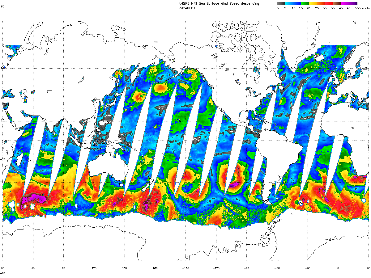 Sea Surface Wind Speed
 Total Precipitable Water
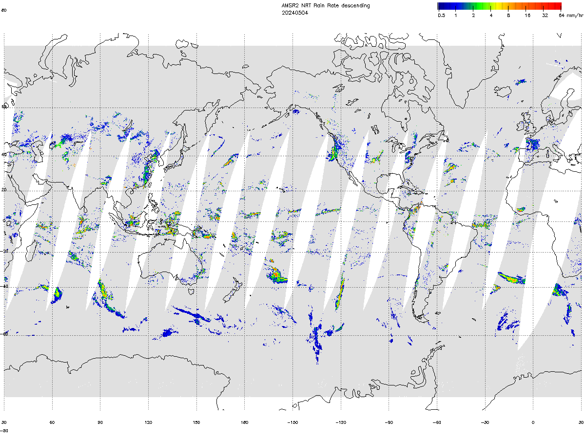
The NOAA Operational GCOM-W1 AMSR-2 Products System (NOGAPS) is developed to process GCOM data and generate NOAA unique operational products for users. It ingests GCOM-W1 AMSR-2 RDRs and generates L1B products with software provided by JAXA and generates L2 products using the GCOM-W1 AMSR2 Algorithm Software Package (GAASP) provided by NESDIS STAR. Both L1 and L2 products are distributed to users through the ESPC NDE system, while L1 products are only made available to restricted users approved by JAXA. The NOAA unique L2 products include: calibrated microwave brightness temperatures, rainfall rate, sea surface temperature, sea surface wind speed, total precipitable water, cloud liquid water, soil moisture, surface type, snow cover, snow depth, snow water equivalent, and sea ice. The GCOM-W1 data and products are expected to be utilized by NOAA users for improving numerical weather prediction, precipitation and tropical cyclone location, intensity analysis, and monitoring. 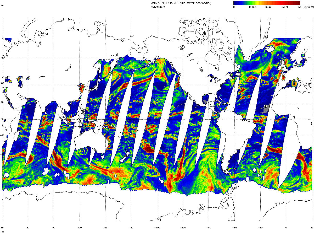 Cloud Liquid Water
|
|