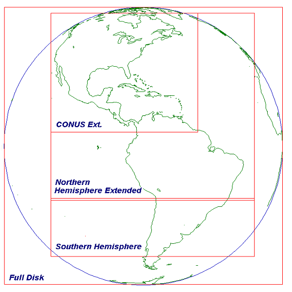
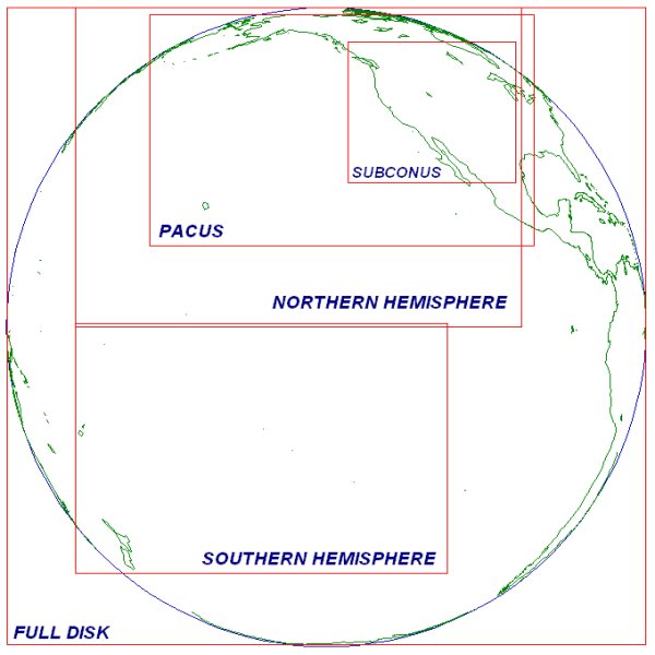
What is a satellite footprint? It is the area of the earth visible to the satellite. The best way to visualize a satellite footprint is to view the full disk image from that satellite. This graphic depicts the GOES-East footprint (full disk image), with a representation of the coverage for the CONUS Extended, Northern Hemisphere Extended, and Southern Hemisphere scan sectors. Here's a link to the same graphic for GOES-West. The ability to accurately view the earth deteriorates near the edge of the footprint, so multiple satellites are used allowing footprints to overlap providing coverage for these areas.
Full Disk Images: