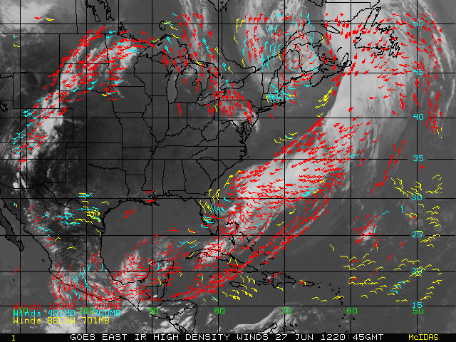
High Density WindsThe satellite derived winds (AMV- Atmospheric Motion Vectors) are generated by incorporating GOES and POES imager and forecast data from a numerical model. The principle of wind derivation is to follow a recognizable tracer (cloud and water vapor features in infrared window and water vapor bands) in a sequence of images, and derive its apparent velocity. The current operational wind products are derived from the following satellites: GOES East, GOES West, NOAA KLNN', MetOp-A, Aqua and Terra. The operational satellite derived winds are available in BUFR format. Wind data is available in McIDAS MD file and ASCII formats via FTP.
|
|