All Satellites | Geostationary | Polar | Geostationary Satellite Server | NOAA Satellite Information System (NOAASIS)
| Bulletins and Notices | Operational Products General Satellite Messages Level 1B Notices Special Bulletins (NOAASIS) Special Bulletins (SPSD) Additional Satellite Information General Satellite Information Satellite Operations Control Center (SOCC) MODIS Status |
|
|
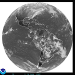
| GOES | Geostationary Operational Environmental Satellite (GOES) Overview Dissemination Schedules | Eclipse Schedules | Information and Links Office of Systems Development (OSD) - Home Page | GOES Page System Status Imagery in the . . . GOES-East Footprint | GOES-West Footprint What is a satellite "Footprint" Selected Image Links: Ocean Sectors: Atlantic | Pacific Regional U. S. Sectors: East | West WFO Sectors: East | West |
|
|
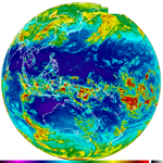
| HIMAWARI-8 | Japan Meteorological Agency (JMA) Satellite Center Satellite Page Imagery From the Japan Meteorological Agency (JMA) Full Disk Images Northern Pacific Countries/Islands (Guam and Micronesia) Southern Pacific Countries/Islands (Fiji, New Zealand, Vanuatu, etc) Pacific Ocean Sectors: West Central Pacific | West Pacific |
|
|
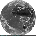
| Meteosat (EUMETSAT) | EUMETSAT Home Page Eclipse Schedules Imagery Full Disk Images |
|
|
| DMSP | Defense Meteorological Satellite Program (DMSP) Overview Ingest Logs |
|
|
| OSTM/Jason-2 | The Ocean Surface Topography Mission (OSTM) Home Page Implementation Satellite Operations Registration Help for Jason-2 Data from CLASS |
|
|
| MetOp | EUMETSAT User Notification Service (UNS) MetOp Home Page MetOp Satellite Operations |
|
|
| POES | Polar-orbiting Operational Environmental Satellite (POES) Overview Ingest Logs and Schedules Launch Schedule Pre-Processing Office of Systems Development (OSD) - Home Page | POES Page Joint Polar Satellite System (JPSS) System Status |
|
|
Additional Links: