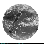
| EUMETSAT Full Disk Geostationary (57° E) | This full disk imagery is from the Eumetsat geostationary satellite located above the earth at 57 degrees East Longitude. It is generated every 6 hours from the MVIRI aboard Meteosat-7 for the Indian Ocean Experiment. Infrared Full Disk | Visible Full Disk To learn more about their data, go to the EUMETSAT Site |
|
|
||
| Meteosat-7 (INDOEX) | Resolution: 4-8 Km | Frequency: 6 hours |
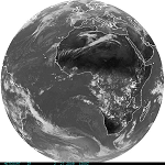
| EUMETSAT Full Disk Geostationary (0° E) | This full disk imagery is from the Eumetsat geostationary satellite located above the earth at 0 degrees East Longitude. It is generated every 6 hours from the MVIRI aboard Meteosat Second Generation MSG-2. Infrared Full Disk | Visible Full Disk To learn more about their data, go to the EUMETSAT Site |
|
|
||
| Meteosat-9 (MSG-2) | Resolution: 1-4 Km | Frequency: 6 hours |
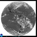
| GOES Full Disk Geostationary | Two GOES satellites provide imagery over the US. GOES East is centered over 75 degrees West Longitude, while GOES West is centered over 135 degrees West Longitude. Full disk infrared, visible, shortwave infrared and water vapor imagery is generated every 3 hours. Page Link GOES East: Infrared | Visible GOES West: Infrared | Visible |
|
|
||
| GOES | Resolution: 24-36 Km | Frequency: 3 hours |
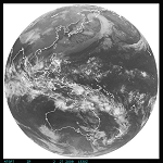
| Japanese Full Disk Geostationary (140E) | This full disk imagery is from the Japan Meteorological Agency geostationary satellite located above the earth at 140 degrees East Longitude. It is generated every hour from MTSAT-1R. Infrared Full Disk | Visible Full Disk To learn more about their data, go to the JMA Site |
|
|
||
| JMA (MTSAT-1) | Resolution: 4-8 Km | Frequency: 1 hour |
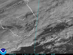
| Severe Storm and Special Events | Six Severe Storm and Special Events Imagery sectors are highlighted. The locations vary depending upon current weather events. Infrared, visible, shortwave infrared and water vapor images and animated loops are available. Generally images are updated every 30 minutes at 1-4 Km resolution. Product Link |
|
|
|
||
| GOES | Resolution: 1-4 Km | Frequency: 30 minutes |
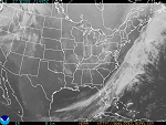
| Synoptic Scale Sectors | GOES East and West Imager data is used to produce synoptic scale standard sectors of imagery. Infrared, visible and water vapor images are generated every 30 minutes with a resolution of 4-8 Km. Product Links: Southern Hemisphere |
|
|
||
| GOES | Resolution: 4-8 Km | Frequency: 30 minutes |
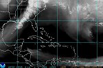
| Tropical Sectors | Infrared, visible, shortwave infrared and water vapor imagery is generated for the following Tropical regions: Pacific, Gulf/Atlantic, Atlantic, Gulf of Mexico, and East Coast. These images and loops are produced every 30 minutes at 4-8 km resolution. Product Link |
|
|
||
| GOES | Resolution: 4-8 Km | Frequency: 30 minutes |