Attention:

We're excited to announce that we've undergone a complete website redesign to enhance your browsing experience! Our fresh new look is designed to make navigation easier and content more accessible. Click here to be taken to the new OSPO homepage. Should you have any questions please reach out to the OSPO Webmaster.

NOAA Office of Satellite and Product Operations

Ocean Surface Topography Products from Jason-3

The interagency Jason-3 mission is a joint efforts by four organizations to measure sea surface height by using a radar altimeter mounted on the low-earth orbiting satellite Jason-3. The four mission participants are:

  • National Oceanic and Atmospheric Administration (NOAA)
  • National Aeronautics and Space Administration (NASA)
  • France's Centre National d'Etudes Spatiales (CNES)
  • European Meteorological Satellite Organisation (EUMETSAT)

This satellite altimetry mission provides sea surface heights for determining ocean circulation, climate change and sea-level rise. The Jason-3 satellite is the follow-on to the research satellites TOPEX/Poseidon, Jason-1, and Jason-2 and is instrumental in meeting NOAA's operational need for sea surface height measurements necessary for ocean modeling, forecasting El Niño / La Niña events, and hurricane intensity prediction.

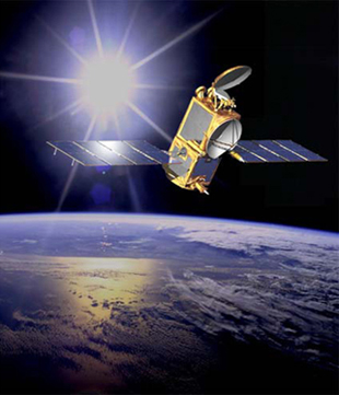
DMSP Satellite
Jason-3 Satellite

Please note: Jason-2 science products ended on October 1, 2019. Please reference CNES Press Release and the NASA Press Release for more information.

Jason-3 Implementation

CNES, EUMETSAT, NOAA and NASA built their fourth joint spacecraft Jason-3, launched January 17, 2016 at 10:42 AM PST (1:42 PM EST), to continue the collection of sea-surface elevation measurements, work that began with the Topography Experiment (TOPEX)/Poseidon mission. Launched in August 1992, the TOPEX/Poseidon satellite used a Radar Altimeter, microwave radiometer, precision satellite tracking, and precision orbit determination as part of a worldwide effort to study and describe global ocean dynamics in relation to Earth's environment and climate change. The success of TOPEX/Poseidon led the agencies to build Jason-1, and was followed on by Jason-2, which collected data from June 2008 until October 2019. Therefore, a decision was made to provide continuity of the ocean surface height dataset by launching the follow-on satellite Jason-3.

The Jason-3 operations are planned for 5 years, comprising the Routine Operations (3 years) and the Extended Routine Operations Phases (2 years).

NASA provided the launch services for the Jason-3 mission. The CNES Mission Operations Center was the primary control center during Launch and Early Orbit Phase (LEOP) and Checkout. Near real time products are created at NOAA Satellite Operation Facility and at EUMETSAT in Darmstadt Germany.

Contacts

The NOAA Program Area Lead is Dave Donahue,and can be emailed at david.r.donahue@noaa.gov