»
OSPO Home
»
DOC
»
NOAA
»
NESDIS
»
OSPO
Products
Atmosphere
Land
Ocean
Suites
Imagery
Hazard Imagery
Hazard Mapping System
Tropical Cyclones
Washington VAAC
Marine Pollution
Sea Surface Temperature
Our Satellites
GOES
POES
JPSS
MetOp
Jason
DMSP
Resources
Satellite Alerts
Ingest Logs
Documents & Reports
INR Statistics
Pre product processing
Data Access
Weekly Operations Plan
Navigation Summary
Services
About
Mission
Leadership
Organization Chart
History
Wallops CDA
Fairbanks CDA
Contact Us
High Density Winds Statistics
Verification Radiosonde Match Time Series
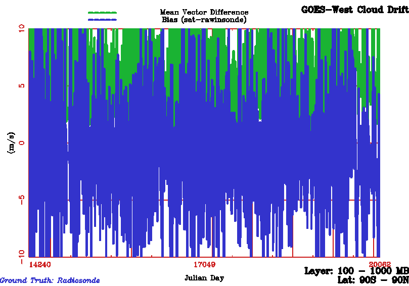
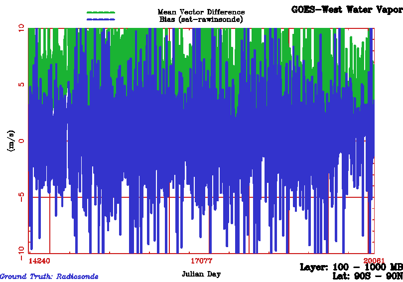
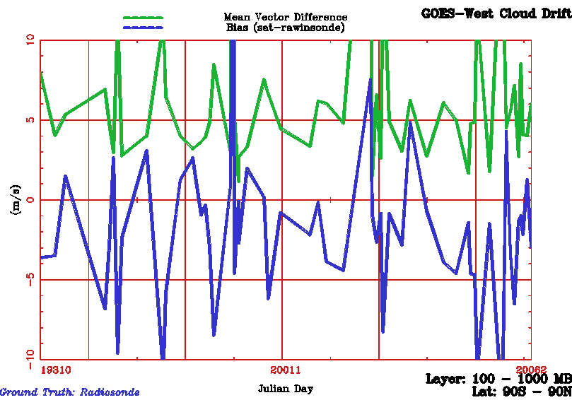
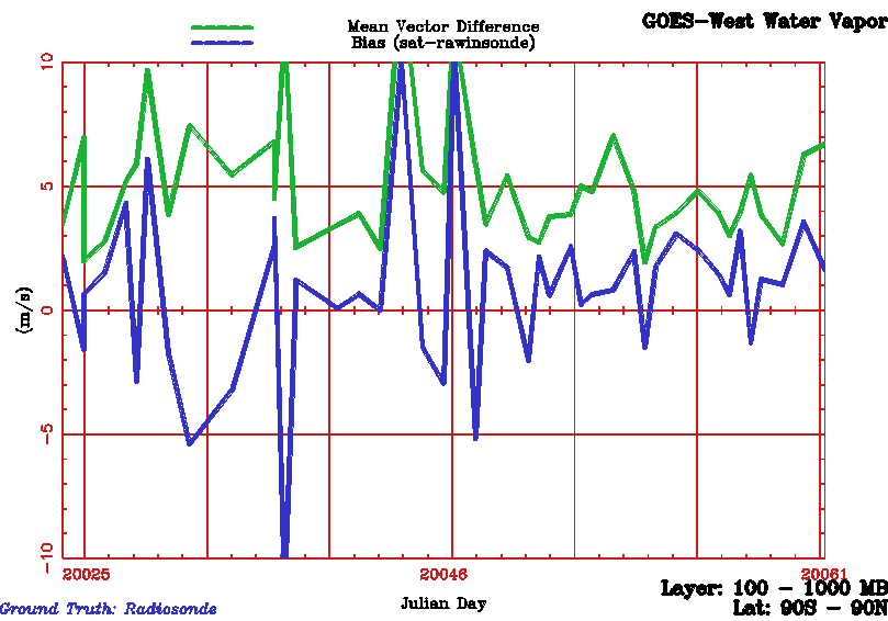
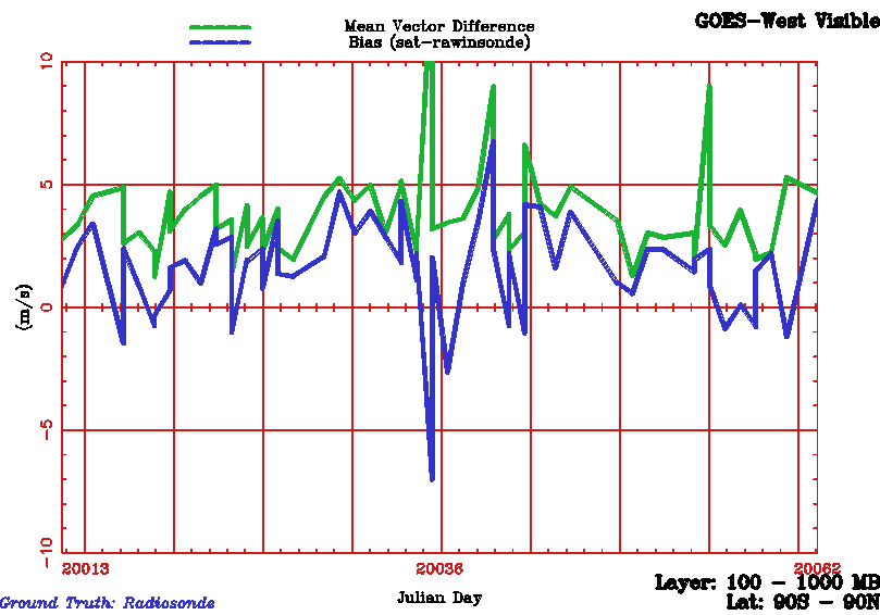
GOES West
Infrared
Water Vapor
Visible
30 day Infrared
30 day Water Vapor
30 day Visible
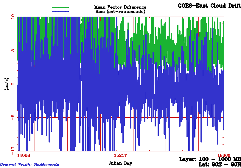
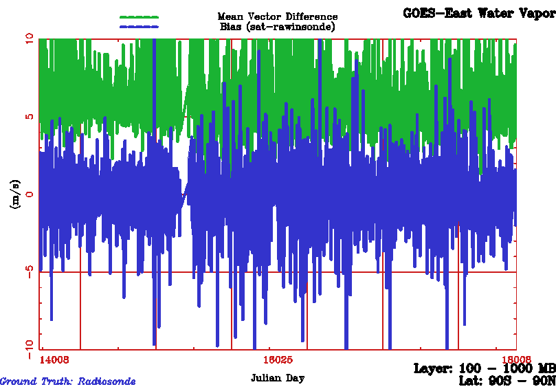
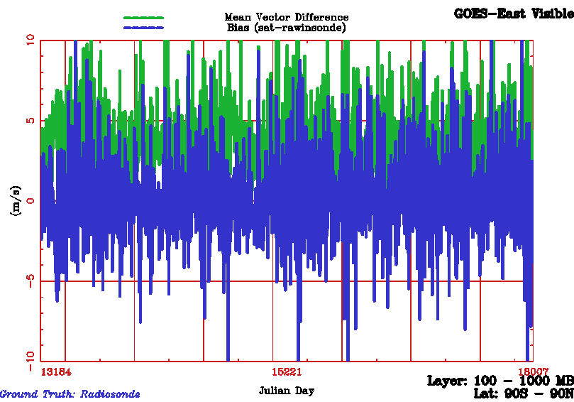
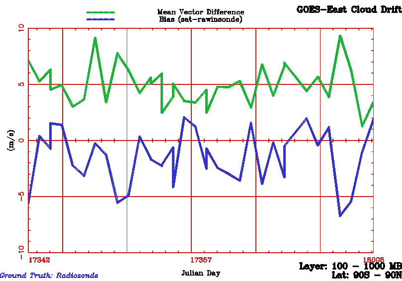
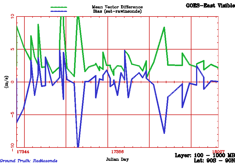
GOES East
Infrared
Water Vapor
Visible
30 day Infrared
30 day Water Vapor
30 day Visible
Daily and Monthly Mean
Number of Vectors Produced per Cycle
GOES West
CDNH(JCCX)
CDSH(JCCX)
WVNH(JGCX)
WVSH(JGCX)
VZNH(JJCX)
VZSH(JJCX)
34200Z
34200Z
34200Z
34200Z
34200Z
34200Z
34203Z
34203Z
34203Z
34203Z
34203Z
34203Z
34206Z
34206Z
34206Z
34206Z
34206Z
34206Z
34209Z
34209Z
34209Z
34209Z
34209Z
34209Z
34212Z
34212Z
34212Z
34212Z
34212Z
34212Z
34215Z
34215Z
34215Z
34215Z
34215Z
34215Z
34118Z
34118Z
34118Z
34118Z
34118Z
34118Z
34121Z
34121Z
34121Z
34121Z
34121Z
34121Z
GOES East
CDNH(JACX)
CDSH(JACX)
WVNH(JECX)
WVSH(JECX)
VZNH(JHCX)
VZSH(JHCX)
34200Z
34200Z
34200Z
34200Z
34200Z
34200Z
34203Z
34203Z
34203Z
34203Z
34203Z
34203Z
34206Z
34206Z
34206Z
34206Z
34206Z
34206Z
34209Z
34209Z
34209Z
34209Z
34209Z
34209Z
34212Z
34212Z
34212Z
34212Z
34212Z
34212Z
34215Z
34215Z
34215Z
34215Z
34215Z
34215Z
34118Z
34118Z
34118Z
34118Z
34118Z
34118Z
34121Z
34121Z
34121Z
34121Z
34121Z
34121Z
A green background indicates the latest run is > -1 standard deviation of the 30 day running mean.
A yellow background indicates the latest run is < -1 standard deviation and > -2 standard deviations of the 30 day running mean.
A red background indicates the latest run is < -2 standard deviation of the 30 day running mean
or the latest run failed.
Wind data available in
McIDAS
MD file and ASCII formats via
FTP
.