Marine Pollution Products
|
||||||||||||||||||||||||||||||||||||||||||||||||||||||||||||||||||||||||||||||||||||||||||||||||||||||||||||||||||||||||||||||||||||||||||||||||
*ERMA Common Operational Picture
|
Monitoring the Oceans for Oil Spills
In December 2008 the NOAA/NESDIS Satellite Analysis Branch (SAB) began to develop the capability of detecting oil slicks in order to meet the request for oil spill support from the Emergency Response Division (ERD). The SAB Marine Pollution Surveillance Program became fully operational in late 2010. Synthetic Aperture Radar (SAR) and multi-spectral satellite imagery is routinely analyzed on a 24x7x365 basis for accidental and intentional crude oil discharges within the U.S. Exclusive Economic Zone (EEZ) and its approaches.
- NOAA National Ocean Service (NOS)
- United States Coast Guard (USCG)
- Bureau of Safety and Environmental Enforcement (BSEE)
- International Customers when requested
Mission Objectives: Provide satellite derived analyses of oil location, extent, and relative thickness (when possible) for oil spill incidences declared by the National Ocean Service Emergency Response Division. Routinely monitor U.S. waters and approaches for accidental and intentional crude oil discharges and report findings to NOS, USCG, and BSEE.
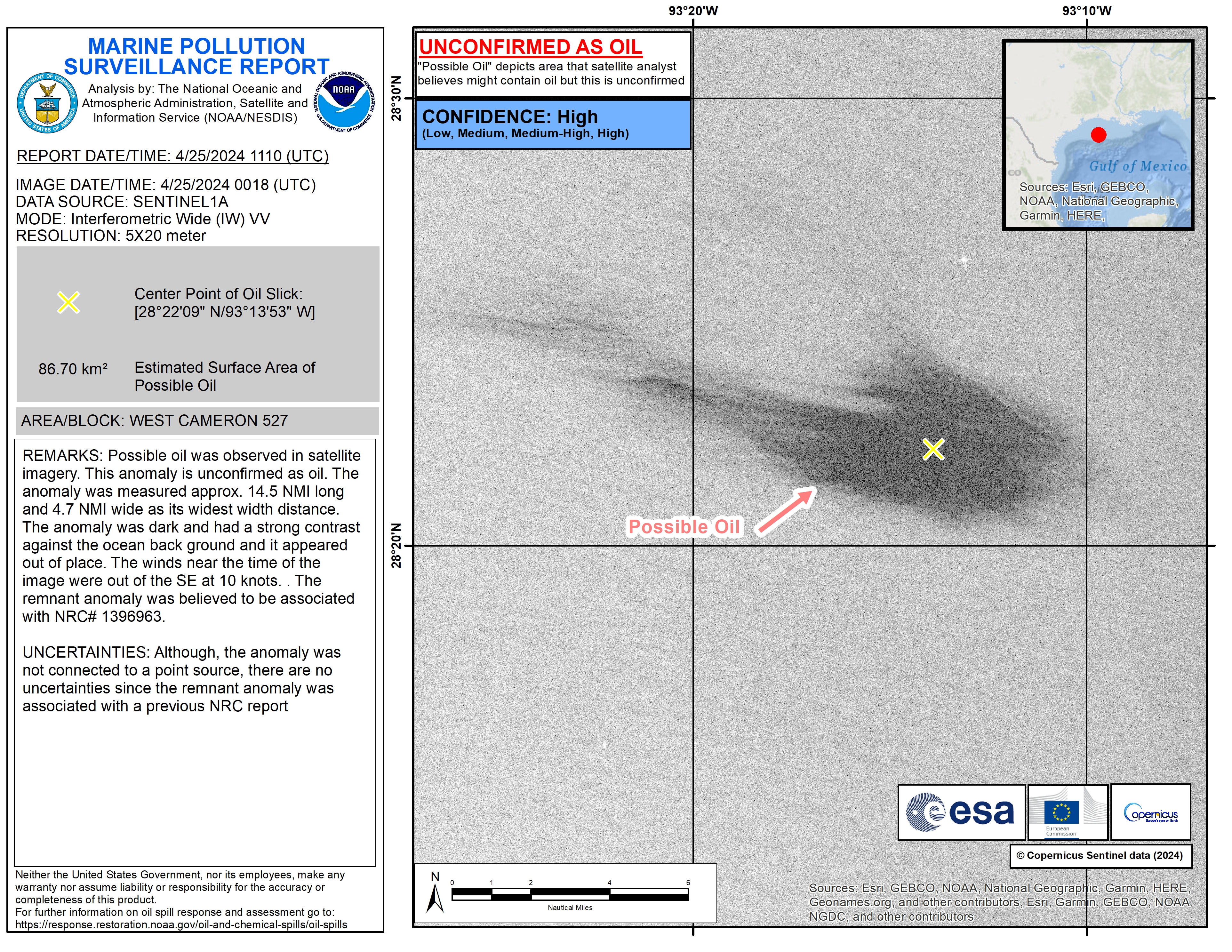
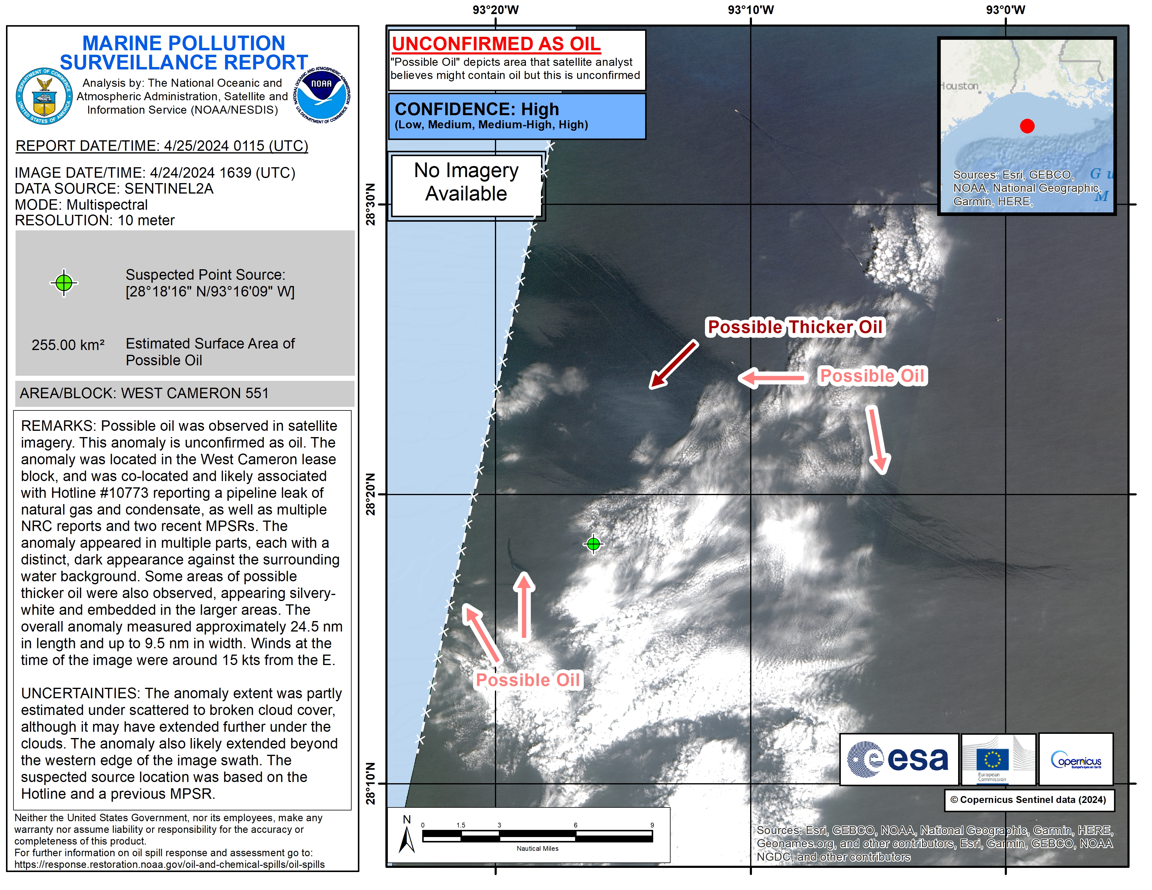
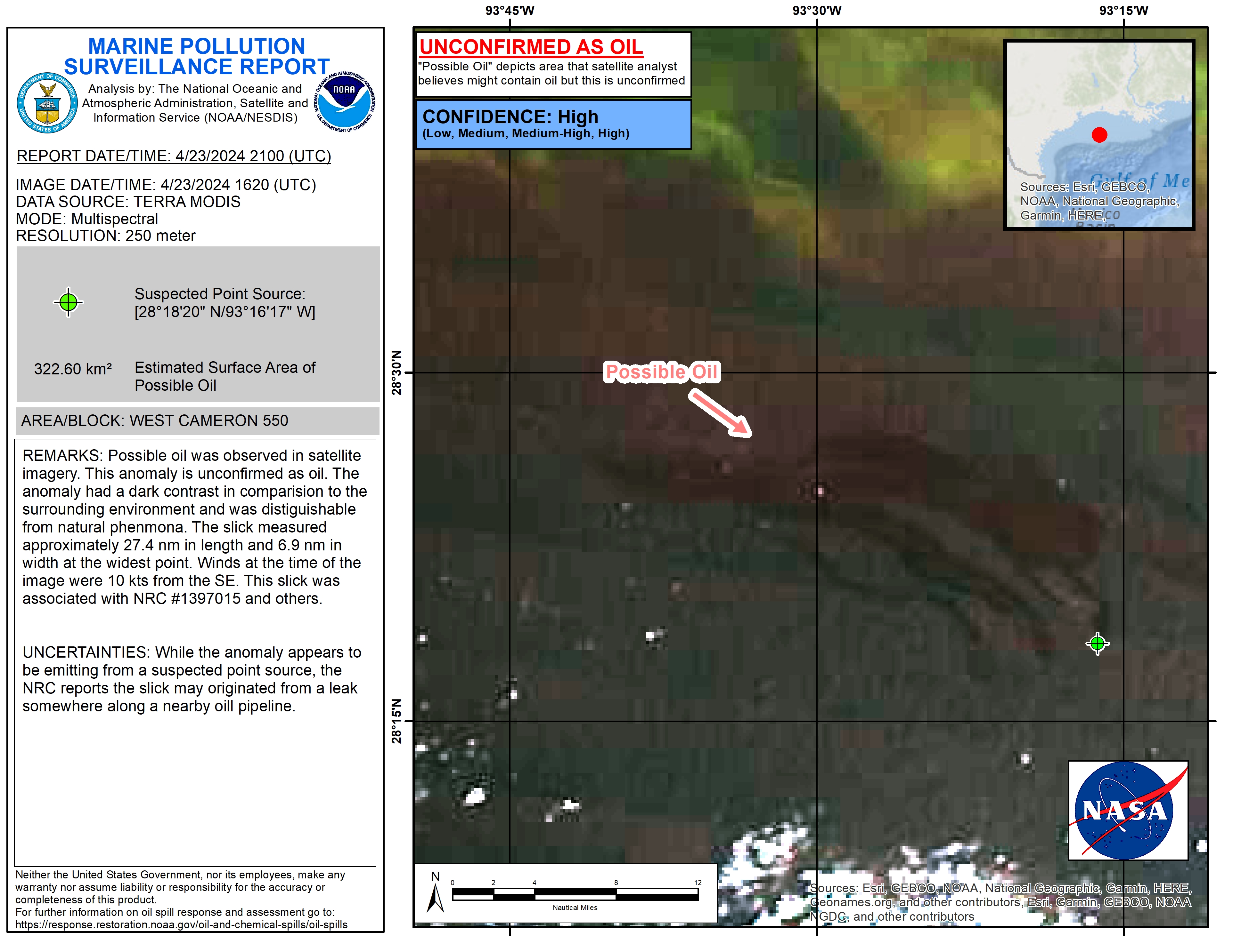
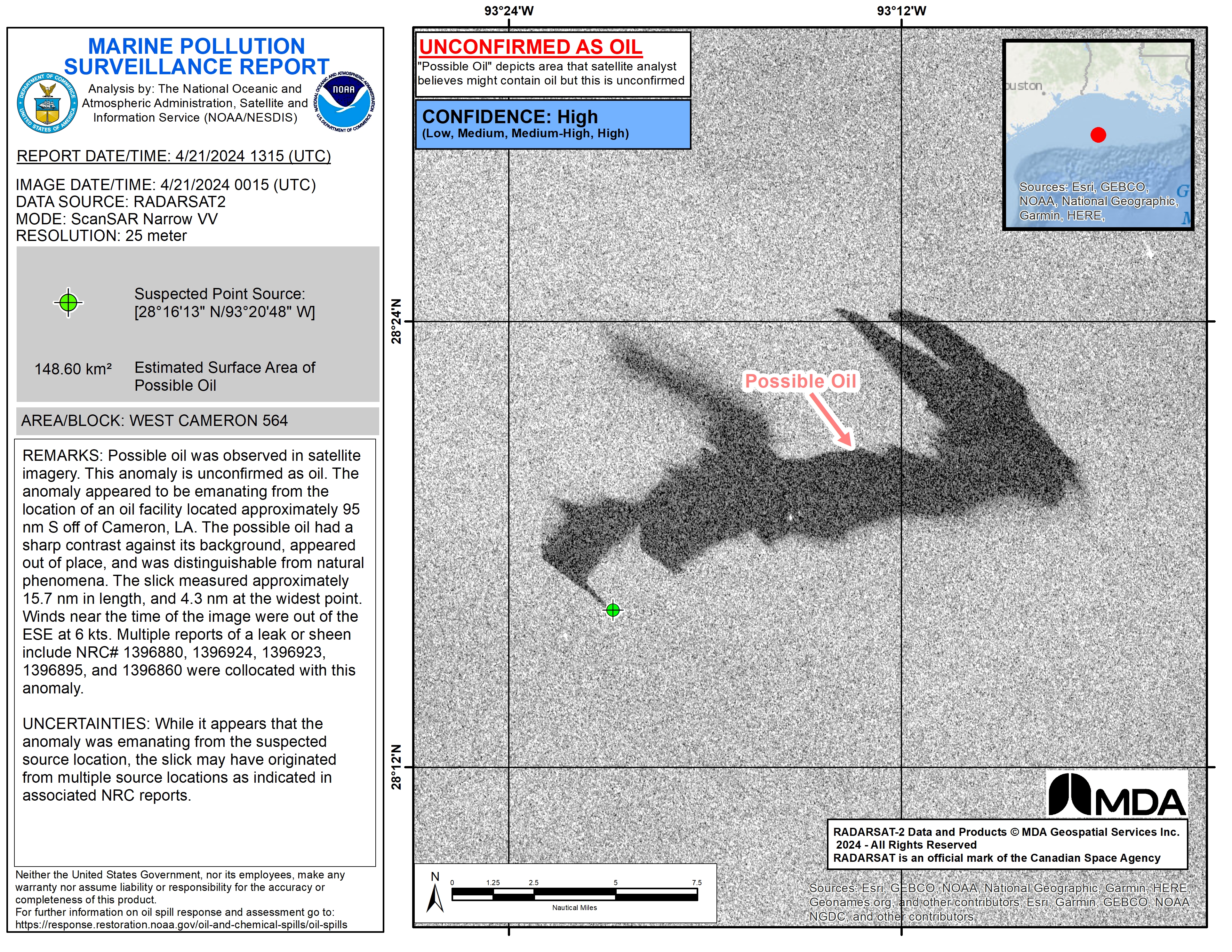
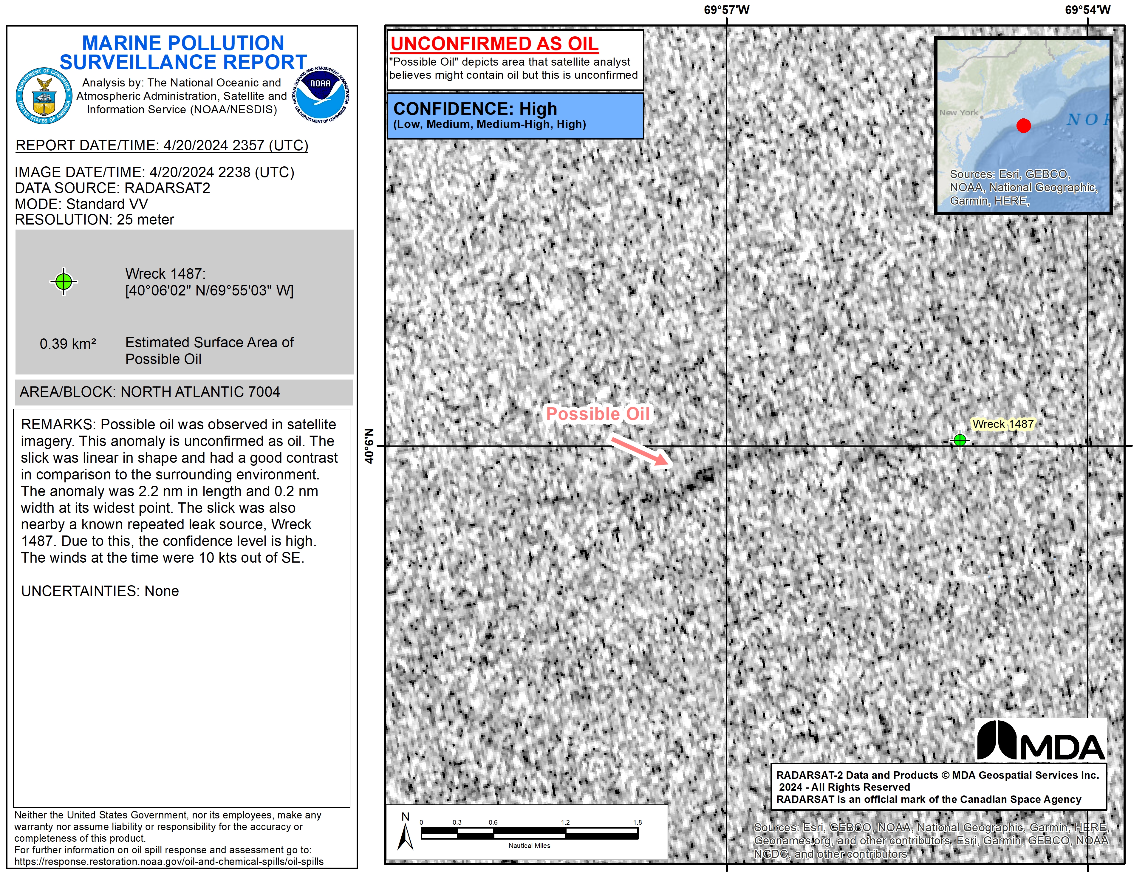
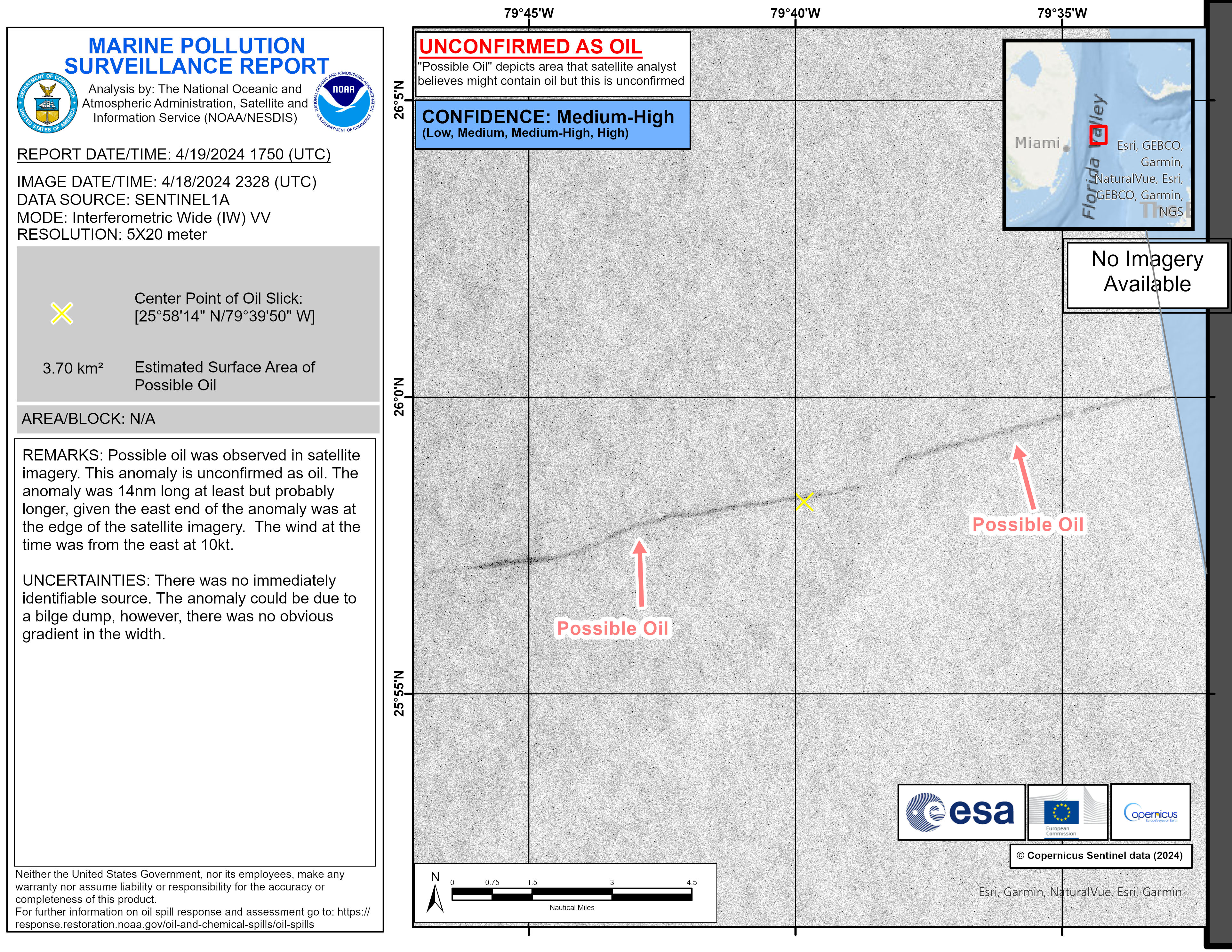
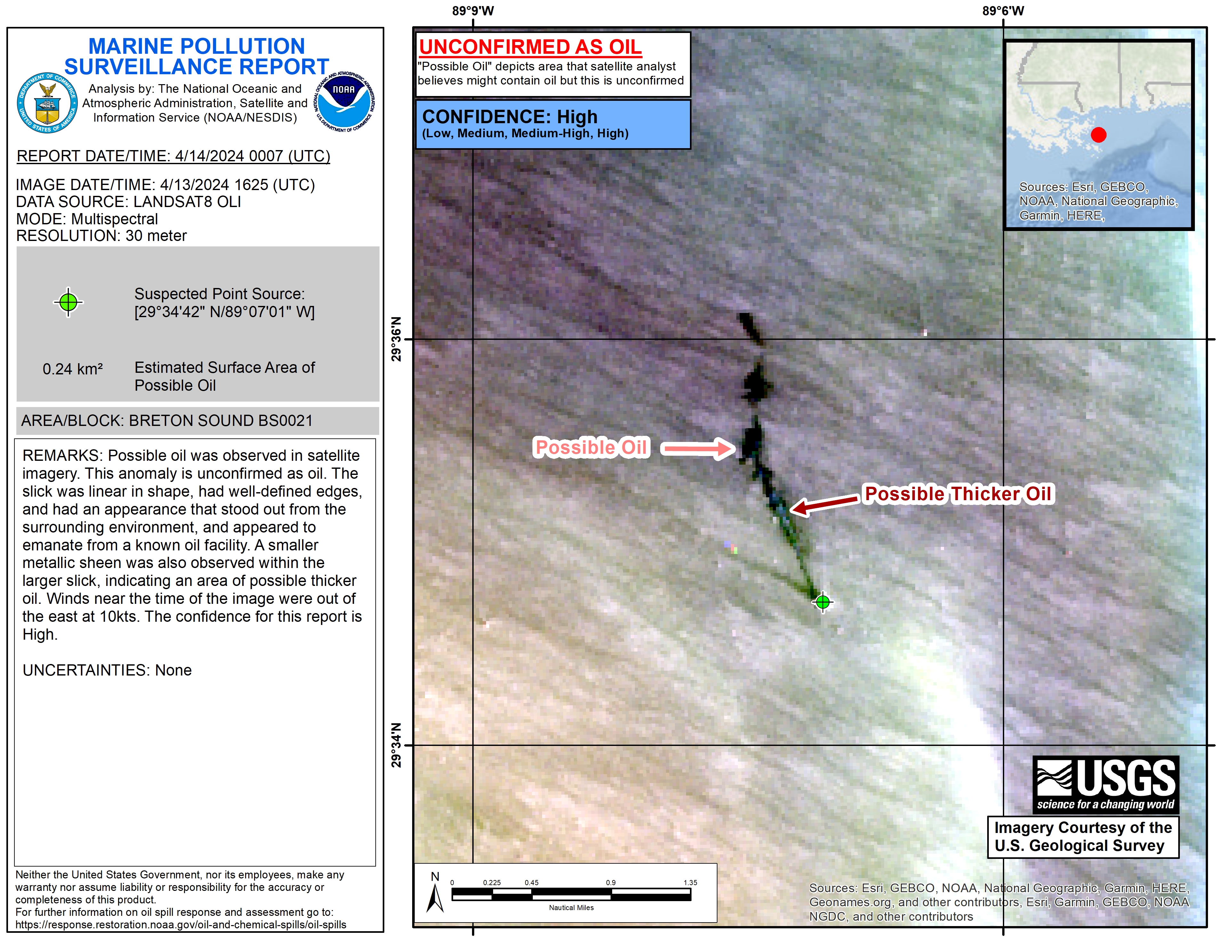
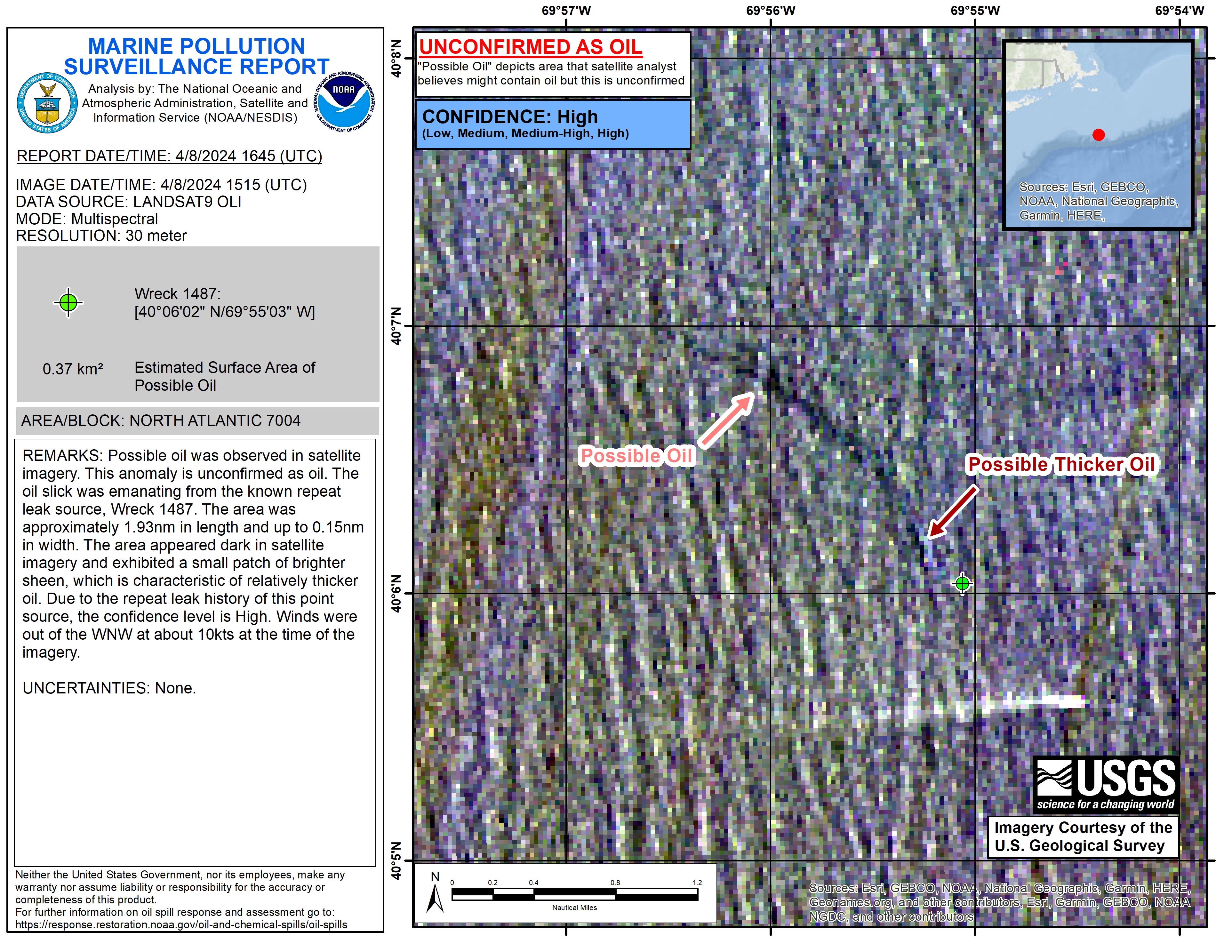
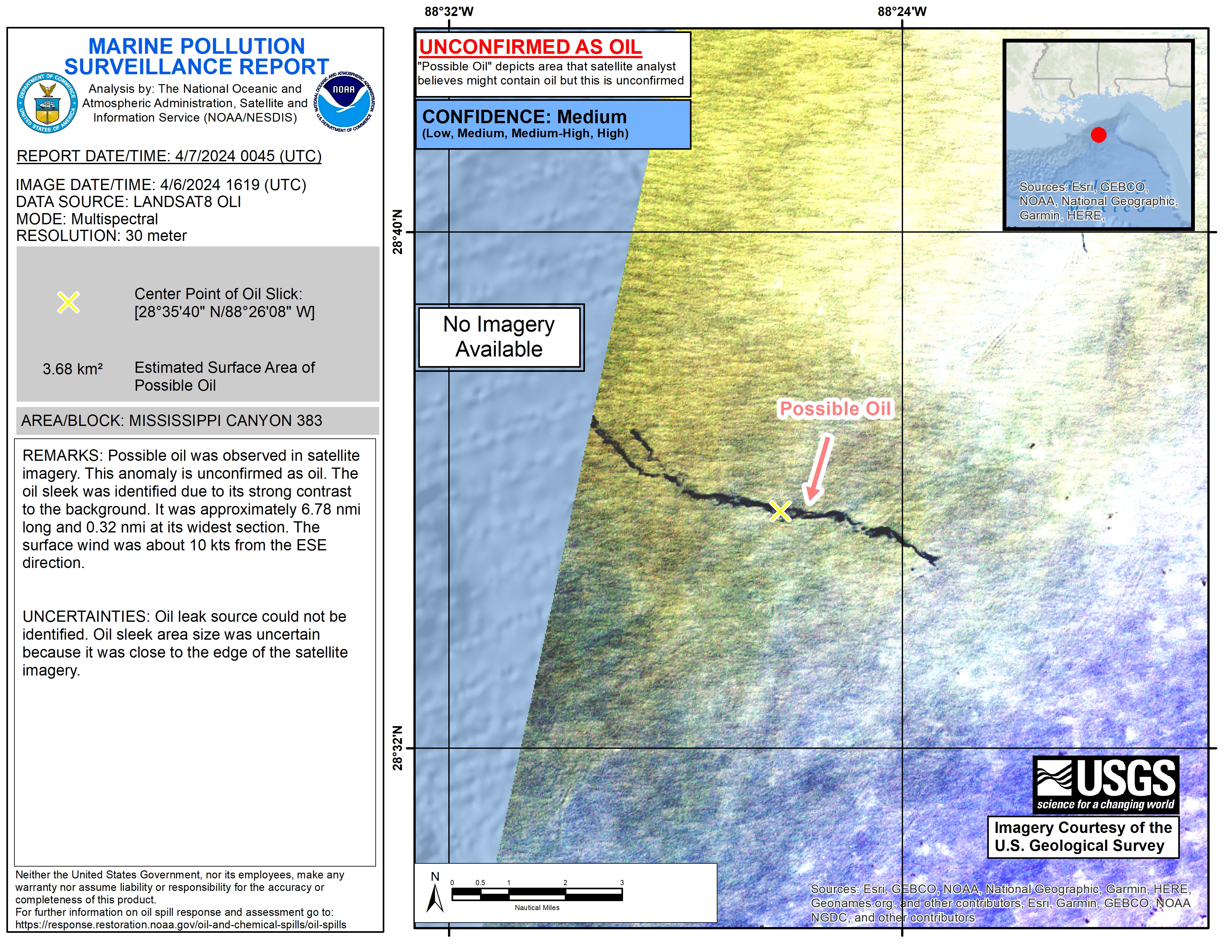
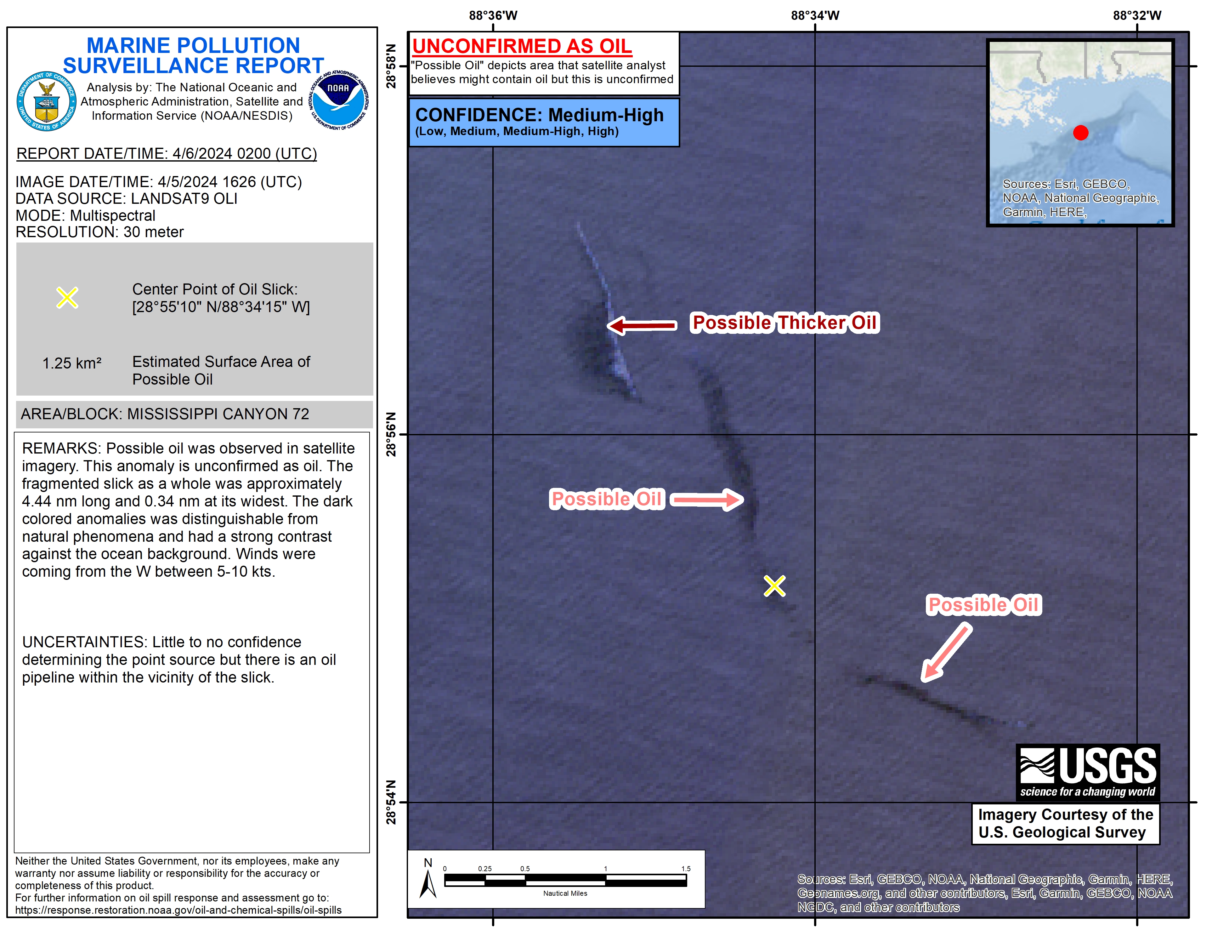
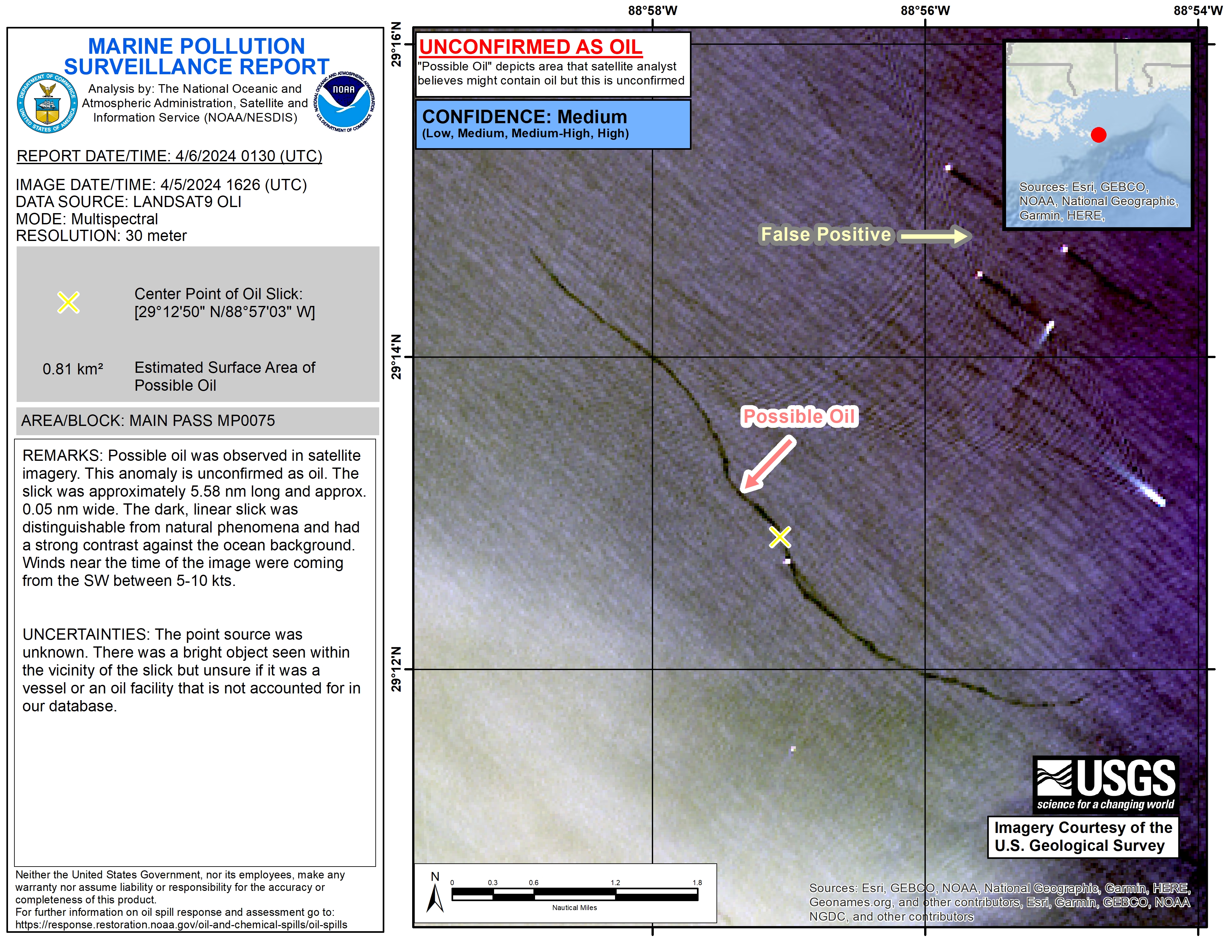
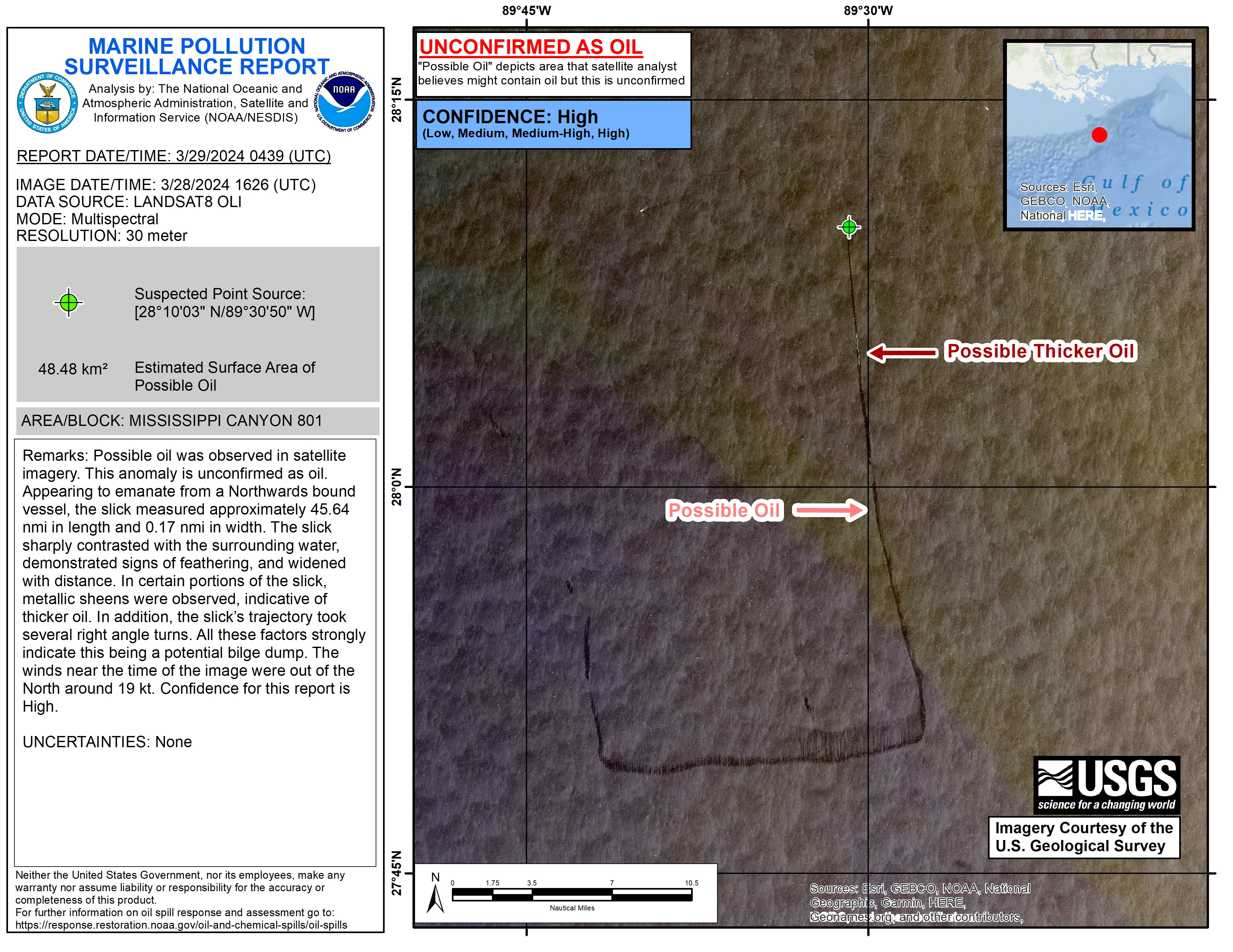
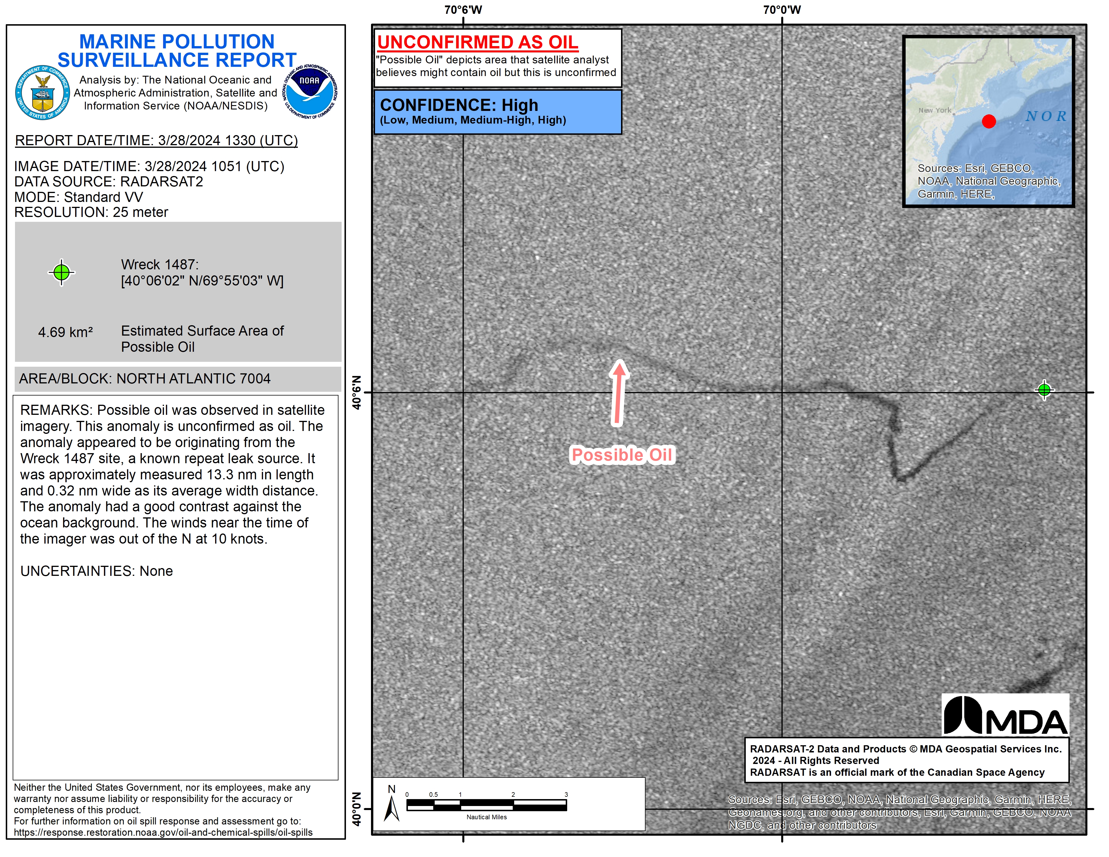
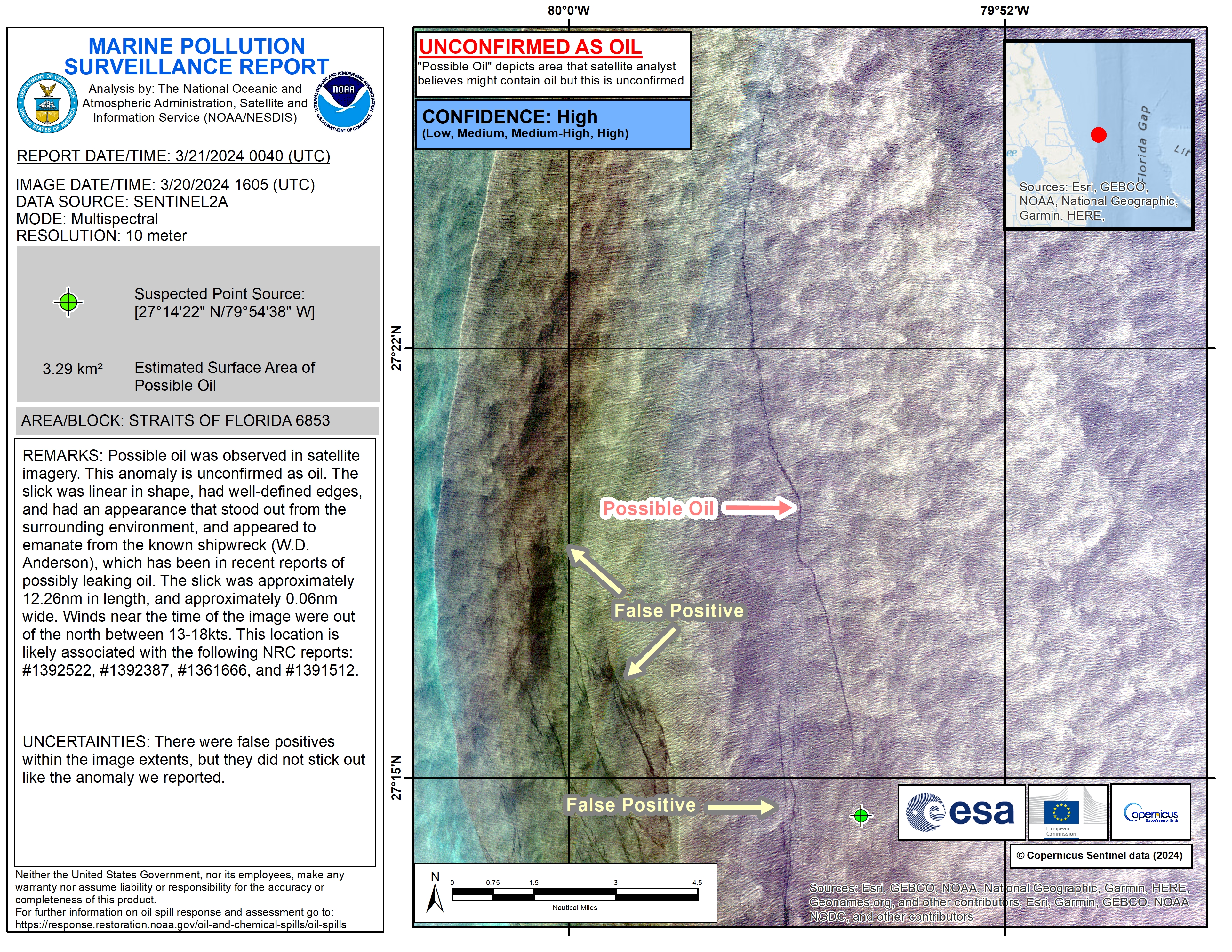
The Marine Pollution Surveillance Report
The Marine Pollution Surveillance Report (MPSR) is created in near real time by an operational analyst when an anomaly believed to be oil is identified in satellite imagery. Reports include the following information:
- Image date and time
- Satellite sensor, spatial resolution, and mode / polarization if applicable
- Report date and time
- Estimated surface area of the oil slick
- Confidence level based on internal criteria and practical experience
- Remarks and uncertainties
- Derived map products in JPEG format
- GIS files
Oil and Marine Debris Related Weblinks: |