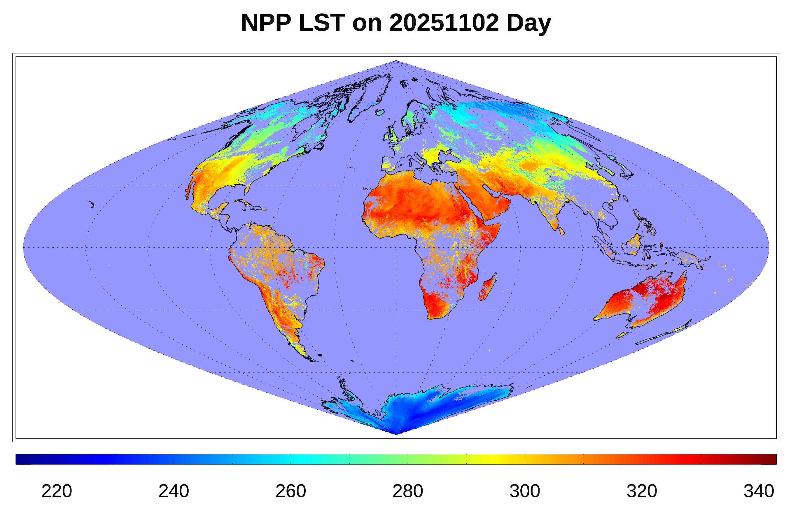
VIIRS Land Surface Temperature (LST)
Land surface temperature (LST), a key indicator of the Earth surface energy budget, is widely required in applications of hydrology, meteorology, and climatology. It is of fundamental importance to the net radiation budget at the Earth surface and to monitoring the state of crops and vegetation, as well as an important indicator of both the greenhouse effect and the energy flux between the atmosphere and ground.
VIIRS LST is produced from VIIRS satellite S-NPP and NOAA-20, for each non-confidently-cloudy land pixel observed by the VIIRS sensor. The LST retrieval will rely on data from VIIRS channels M15 and M16 using split window technique, which corrects for atmospheric absorption, and applies surface emissivity explicitly in the retrieval. Coefficients of the LST algorithm, which were derived using an atmospheric radiative transfer model (RTM), are stratified by daytime and nighttime conditions, multiple levels of viewing geometry and dry and moist atmospheric conditions. The algorithm is then verified using a RTM simulation dataset and evaluated using S-NPP (NOAA-20) VIIRS dataset and ground measurements.
The VIIRS LST product is in Netcdf4 format, which includes LST values, associated quality flags as well as the related emissivity values including the spectral emissivity of the two split window channels, broadband emissivity and associated emissivity quality flags. To minimize the file size, the LST value is stored as a scaled value in 16-bit integer type. The emissivity value is stored as scaled value in 8-bit integer type. Scale factor and offset as well as valid range, fill value etc. are provide as the data attributes. The quality flags are 2-byte bitwise short integer, which contains quality information of LST production for each pixel. Upon user request, the viewing geometry including satellite zenith angle and azimuth angle is also added into the LST output.
For more information view our documents page VIIRS Land Surface Documents.


