
The Fairbanks Command and Data Acquisition (CDA) Station is NOAA’s primary satellite ground station for downloading data from and sending commands to polar orbiting satellites. The Station has nine antennas in active use and is one of the busiest and most capable satellite ground stations in the world. The Station has a reputation for reliability as demonstrated by a 99.89% data set capture success rate for 2016.
The Fairbanks CDA Station (FCDAS) is located on 8000 acres (32 sq-km) of Federal land and is a fifteen minute drive on the Steese Highway from downtown Fairbanks, Alaska. Fairbanks is the second largest city in the state and serves as a regional hub for half of the state--more than the area of Texas. The Fairbanks economy is driven by military, government, higher education, mining, oil industry, and tourism spending.
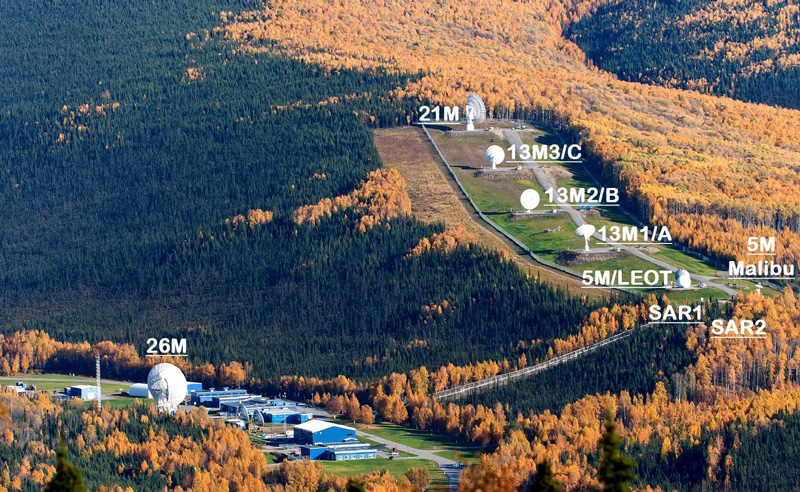
As of 2017, the Station supports 21 satellites that are part of 12 missions. Most are US missions. Foreign missions are also frequently supported through partnerships that benefit the US, in particular, those that support the NOAA National Weather Service. The Fairbanks CDA Station is open for business and welcomes satellite operations work from around the world. More than a 140 times a day and 50,000 times per year, the station receives downlinked mission and science data, telemetry, tracking and command data, and transmits commands to spacecraft. The Station uses the Space-Ground Link Subsystem (SGLS) to support Air Force weather satellite operations and has multiple connections to high-bandwidth fiber networks.
In addition to being the Nation’s premier civilian ground station in support of polar orbiting satellites, the Fairbanks CDA Station also acts as a backup in support of NOAA’s primary geostationary satellite ground station, the Wallops CDA Station on Wallops Island on the Eastern Shore of Virginia. Fairbanks provides backup support for the geostationary (GOES) satellites orbiting in the West position. FCDAS also supports the DSCOVR mission, a critical space weather observatory orbiting the first Lagrangian point (L1) between the Earth and Sun that is 1,481,000 km (920,000 miles) distant.
The Fairbanks CDA Station is a government owned, contractor operated facility. Three government staff oversee a contractor staff of 47 managers, operations and maintenance technicians, equipment operators, laborers, electricians, and security guards. The site is staffed and operated 24x7x365 and has a complex electronics and antenna configuration and extensive physical plant with 70,000 sq-ft (6500 sq-m) of structures, many of which are decades old. The contractor is Arctic Slope Regional Corporation (ASRC) Federal Technical Services (ASTS) with a base year of federal FY2017 and four option years through FY2021. This partnership is responsible for the high performance of the station as demonstrated by 99.89% success in 2017 and similarly high levels of performance going back more than a decade. The Station is capable of three weeks of stand-alone operations under generator power drawing on 60,000 gallons of stored fuel in the event of extended commercial power disruption.
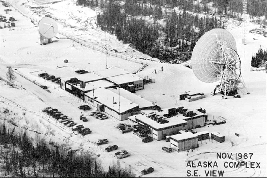
The Station has a long history extending back to 1962 supporting NASA and NOAA missions, including the first US weather satellites, the Television Infrared Observation Satellites (TIROS) and the early Landsat missions. At its peak staffing in 1980 the station employed 235 employees on site.
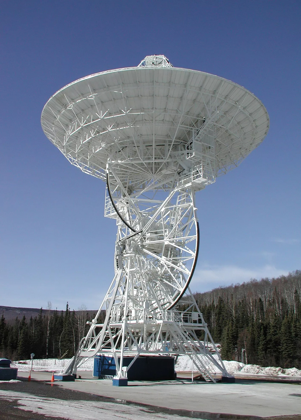
FCDAS is also a long term contributor to geodesy. The station is home to a (now decommissioned) very long baseline interferometry (VLBI) 26 meter antenna that help establish important properties of the Earth in support of navigation and earth science in the pre-GPS days. Currently the station hosts a GNSS (GPS) reference station (SiteID: FAIR), operated by UANVCO for the NASA Global Geodetic Network, that contributes to NOAA’s Continuously Operating Reference Station (CORS) system. The CORS system is vital to surveyors and those operating with a need for precision navigation, such as airlines.
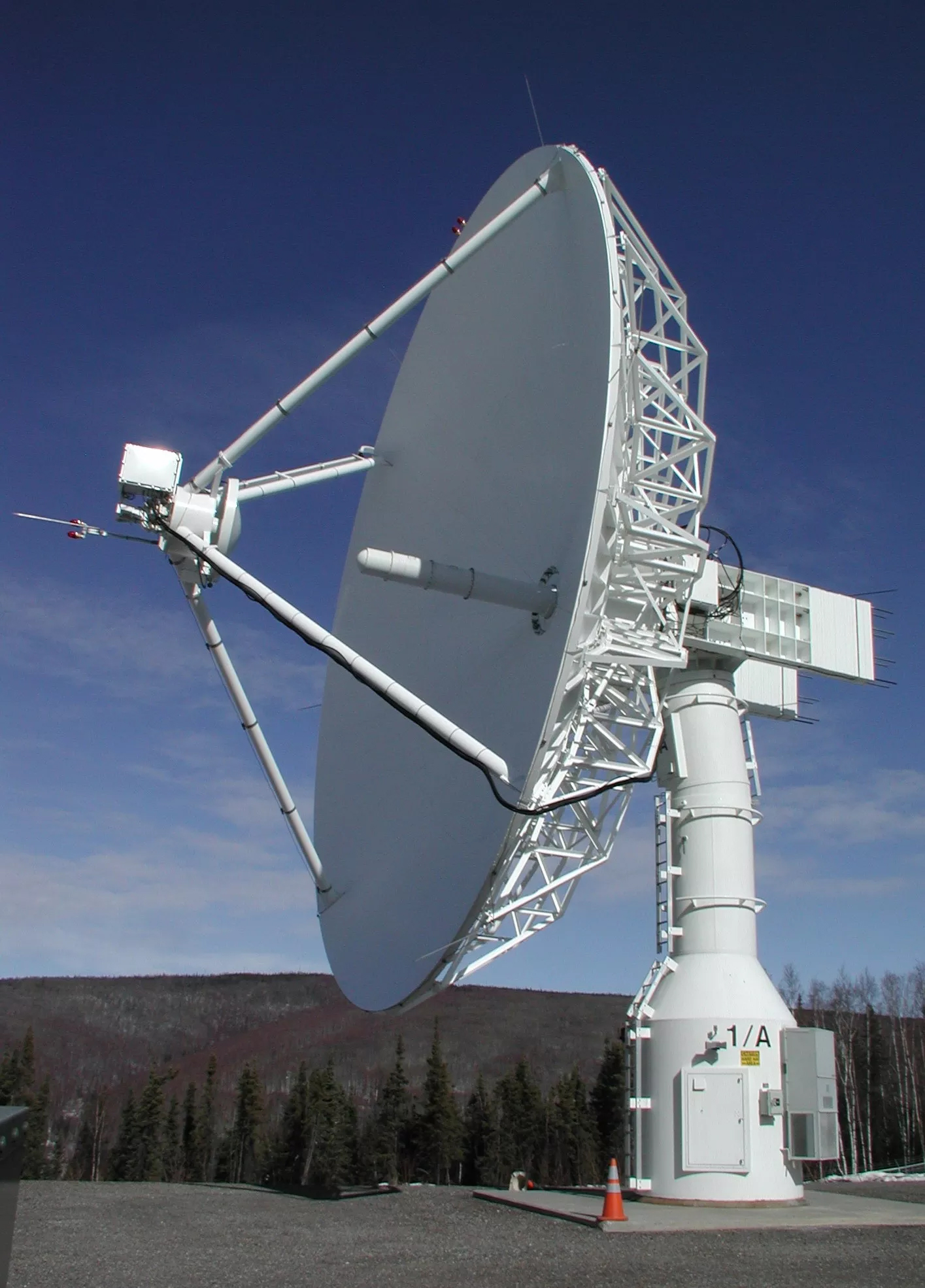
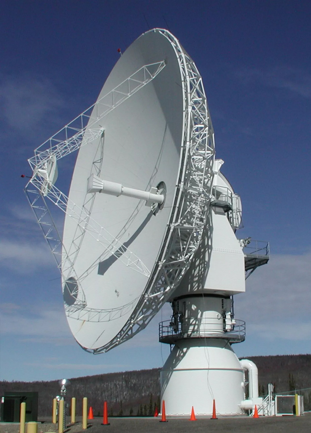
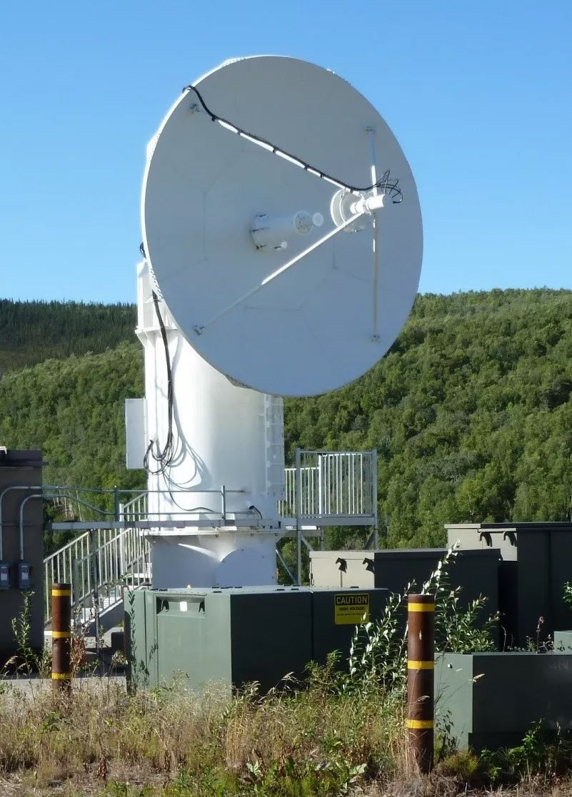
| Antenna | Receive Bands | Gain/Temp (dB/K) | Transmit Bands | Latitude (N) | Longitude (E) | Elevation (m) |
|---|---|---|---|---|---|---|
| 26 METER | VHF/L/S | 27dBi/24/28 | None | 64° 58' 36.176" | 12° 28' 56.803" | 316.1 |
| 13 METER 1/A | L/S/X | 20/24/38 | L/S | 64° 58' 26.400" | 212° 29' 24.396" | 378.4 |
| 13 METER 2/B | L/S/X | 19/24/37 | L/S | 64° 58' 25.716" | 212° 29' 39.300" | 396.7 |
| 13 METER 3/C | L/S/X | 20/23/36 | L/S | 64° 58' 24.492" | 212° 29' 53.412" | 415.7 |
| 21 METER | L/S | 31/33 | S | 64° 58' 21.9" | 212° 29' 56.04" | 447.3 |
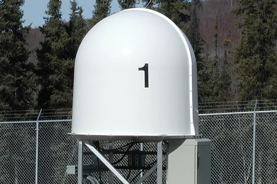
| 5 METER MALIBU | S/X | 16/28 | S | 64° 58 23.834" | 212° 28' 59.067" | 352.4 |
| 5 Meter LEO-T | S/X | 17 | S | 64° 58' 24.96" | 29' 2.17" 347.5 | 347.5 |
| MEOLUT 1 | 406 MHz | n/a | None | 64° 58' 25.590" | 212° 28' 58.220" | 444.1 |
| MEOLUT 2 | 406 MHz | n/a | None | 64° 58' 25.180" | 212° 28' 56.070" | 444.7 |
| 4.06 METER KA | Ka | 28 | None | 64° 58' 23.200" | 212° 29' 38.200" | 384.9 |
| Antenna | Receive Bands | Gain/Temp (dB/K) | Transmit Bands | Latitude (N) | Longitude (E) | Elevation (m) |
|---|---|---|---|---|---|---|
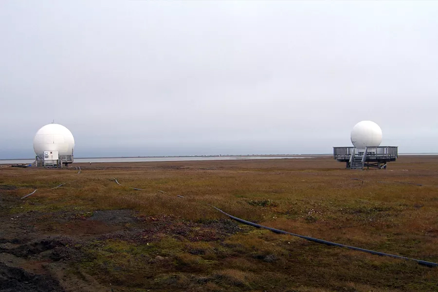
| BARROW 5 METER | S | 17 | S | 71° 19' 25.0" | 203° 23' 20.85" | 14.8 |
| BARROW 2.4 METER | L/X | 7/24 | None | 71° 19' 24.0" | 203° 23' 22.0" | 4.8 |
1300 Eisele Road
Fairbanks, Alaska 99712
Location Map
+1-907-451-1200